


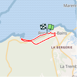
ronce les bains 22.01

MAITHE
User

Length
7.1 km

Max alt
21 m

Uphill gradient
55 m
Km-Effort
7.9 km

Min alt
0 m

Downhill gradient
51 m
Boucle
Yes
Creation date :
2018-04-17 16:43:30.481
Updated on :
2018-04-17 16:43:30.481
2h00
Difficulty : Unknown

FREE GPS app for hiking
 SityTrail
IGN / Geographical institutes
SityTrail Plus
The world is yours!
About
Trail Walking of 7.1 km to be discovered at New Aquitaine, Charente-Maritime, La Tremblade. This trail is proposed by MAITHE.
Positioning
Country:
France
Region :
New Aquitaine
Department/Province :
Charente-Maritime
Municipality :
La Tremblade
Location:
Unknown
Start:(Dec)
Start:(UTM)
642077 ; 5072867 (30T) N.
Comments